


montessorikiwi
Oceania Flag Pin Map Printable | Montessori Geography & Continent Study
Oceania Flag Pin Map Printable | Montessori Geography & Continent Study
Couldn't load pickup availability
Help children discover the countries, territories, flags and capital cities of Oceania through purposeful, hands-on Montessori map work.
Oceania is much more than Australia and New Zealand. Yet many classroom maps leave out the smaller Pacific nations and territories that make this region so geographically and culturally rich.
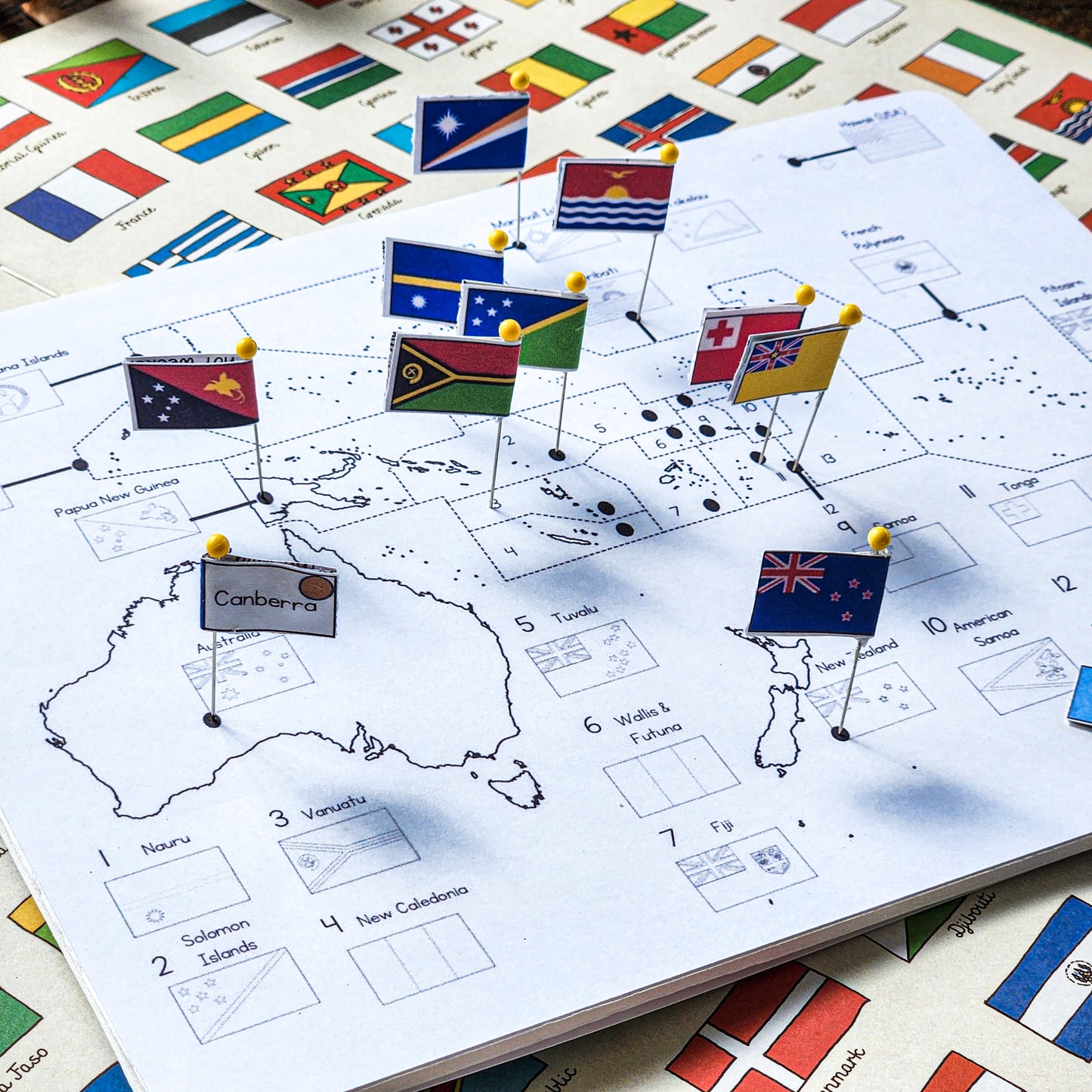
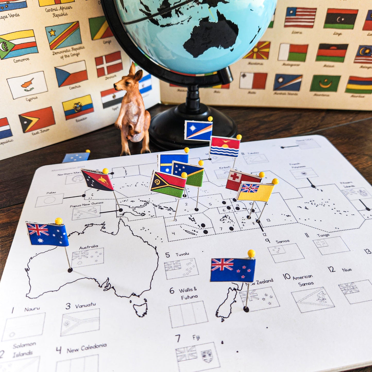
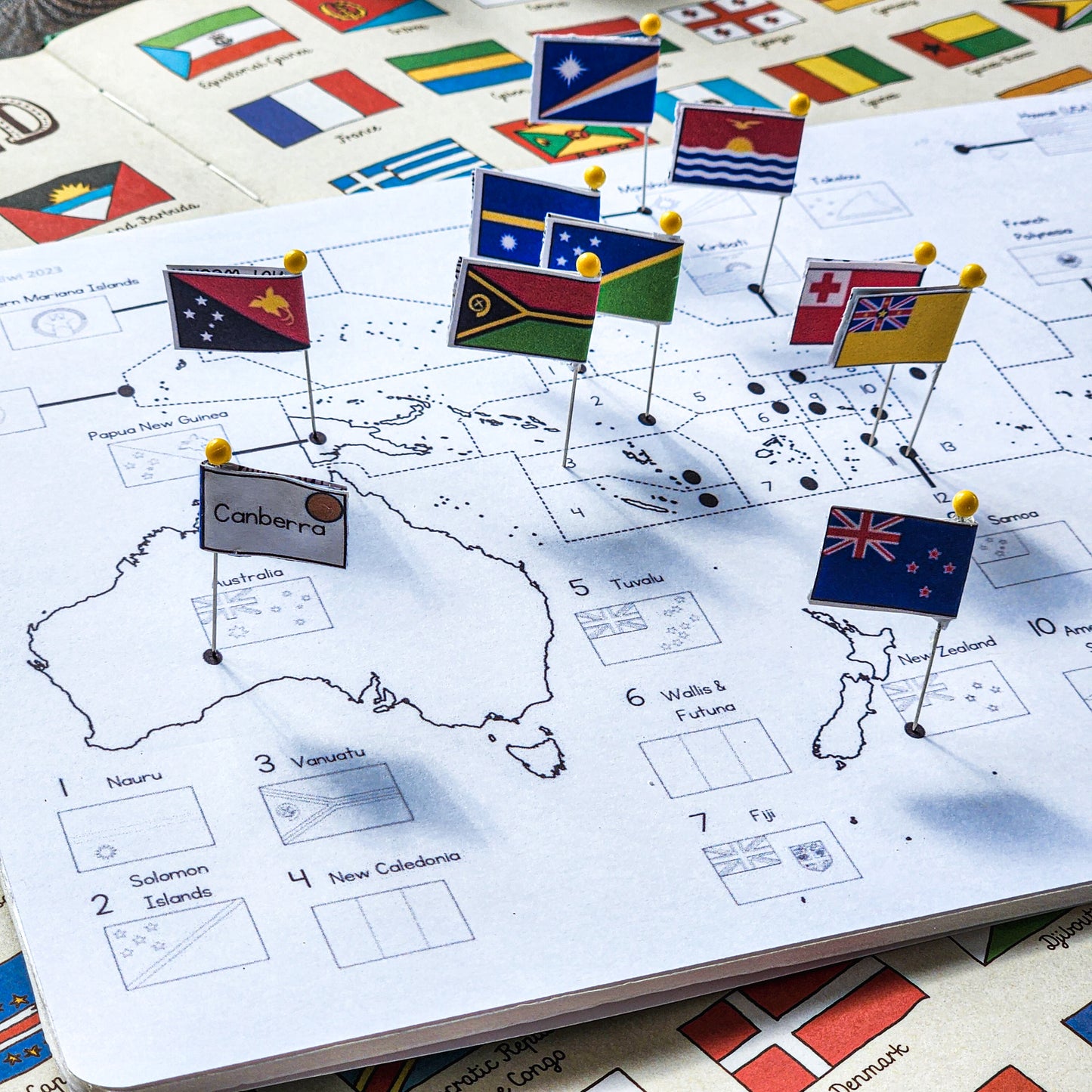
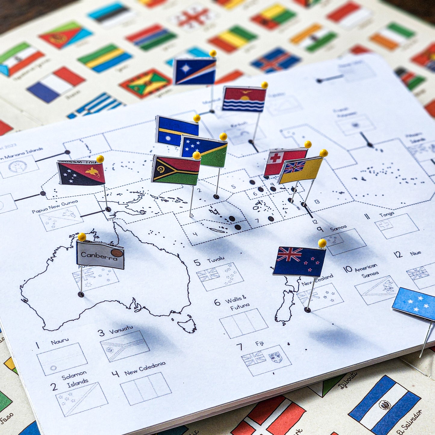
This printable Montessori Oceania Pin Map helps children locate places across the Pacific, recognise national flags and connect each country or territory with its capital city. It is ideal for Montessori elementary classrooms, homeschool geography, continent studies, cultural work and independent shelf activities.
At a glance
Best for: Montessori geography, Oceania studies, Pacific studies and cultural shelves
Age range: Approximately 6–12 years
Format: 3-page printable PDF
Includes: Two Oceania maps plus coloured flag-and-capital labels
Preparation: Print, cut and attach the labels to sewing pins or map pins
Please note: This is a digital download. No physical product will be shipped.
A more inclusive way to teach Oceania
Many traditional geography resources focus almost entirely on Australia, sometimes adding New Zealand while overlooking the many island nations and territories spread throughout the Pacific.
This material offers children a broader view. Alongside Australia, New Zealand and Papua New Guinea, students encounter places such as Kiribati, Palau, Niue, Tokelau, Tuvalu, Samoa, Tonga, the Marshall Islands, the Cook Islands and Wallis and Futuna.
Children can use the map as a concrete starting point before moving into deeper work involving Pacific cultures, environments, landmarks, histories and contemporary issues.
What is included?
- One labelled Oceania map with flag outlines, country and territory names, and numbered locations
- One simplified map showing the names and locations of countries and territories
- Coloured printable flag labels
- Capital-city names paired with the flags
- Montessori continent-colour dots on the labels
- Coverage of Australia, New Zealand and countries and territories throughout the Pacific
Countries and territories represented
Australia, New Zealand, Papua New Guinea, Palau, Northern Mariana Islands, Marshall Islands, Hawaii, Kiribati, French Polynesia, Pitcairn Islands, Nauru, Solomon Islands, Vanuatu, New Caledonia, Tuvalu, Wallis and Futuna, Fiji, Tokelau, Samoa, American Samoa, Tonga, Niue and Cook Islands.
What children can practise
- Locating countries and territories within Oceania
- Recognising and matching national flags
- Learning capital cities
- Reading and interpreting a regional map
- Using an atlas or reference book independently
- Developing concentration, fine-motor control and visual discrimination
- Preparing for independent country and cultural research
- Understanding Oceania as a diverse Pacific region rather than simply another name for Australia
How to use the Oceania pin map
- Print the map onto cardstock or mount it onto corkboard, foam board or another pin-friendly surface.
- Print and cut out the flag-and-capital labels.
- Laminate the labels if you would like them to withstand repeated classroom use.
- Attach each label to a sewing pin or map pin.
- Provide an atlas, flag book or other geography reference so children can locate and check each place independently.
The map can also be used without pins. Children can place the labels directly onto the map, use them for matching work or select one location for further research.
Use it for
- Montessori continent studies
- Elementary cultural geography
- Oceania and Pacific studies
- Independent geography shelf work
- Continent boxes
- Flag studies
- Capital-city revision
- Homeschool geography
- Country research invitations
- Follow-up work after a Montessori geography presentation
Build a complete pin-map collection
Need maps for more than one region? The Montessori Pin Map Bundle brings the continent pin maps together so you can create a coordinated geography area while saving compared with purchasing each map separately.
Continue your Oceania study
Oceania Fact Cards
Extend the map work with facts about countries and territories throughout the South Pacific, including flags, capitals and memorable information.
Australia and Oceania Places
Connect locations on the map with real landmarks and natural features from Australia, New Zealand and Pacific Island nations.
Continent Geography Projects
Move from identifying places to researching climates, rivers, landmarks, animals, physical features and human geography.
Free geography follow-up
Children can record and organise what they learn with the free Continents of the World Interactive Notebook.
Read more about teaching Oceania
- How 40 Million People Are Not on the Maps in Your Classroom: Oceania Exists — Why Pacific nations and territories deserve meaningful representation in Montessori geography.
- Questions About Teaching Oceania — Responses to common questions about Australia, Oceania and inclusive continent studies.
- Let’s Move Past the Traditional Montessori Puzzle Maps — Questions to consider when creating more inclusive and thoughtful geography work.
- Geography Extensions for Your Montessori Elementary Classroom — Practical ideas for moving children beyond repeatedly completing puzzle maps.
Please note
- This is an instant digital PDF download.
- No printed product, corkboard or pins will be mailed to you.
- Students will need access to an atlas, flag book or another reliable reference source.
- The file is secured and cannot be edited.
- Colours may vary slightly depending on your printer and screen settings.
Created by a practising Montessori educator
I’m Lisa—a Montessori-trained teacher, New Zealand registered teacher, school principal and former homeschooler. I create resources for real mixed-age classrooms, including children with diverse learning needs.
My materials are designed to encourage independence, curiosity and meaningful learning while remaining practical and manageable for busy teachers and homeschool families.
Share

-
Items are secured / Terms of Use
Our items are secured. They are not able to be altered. We secure our items because they are our intellectual property and because we use art from artists who require that we secure our files.
You may not:
-resell our items or use them for commercial gain
-claim these items as your own
-modify this resource
-share them with others by any means e.g. electronic or hard copy
-
All Items are instant downloads
You will not get a printed product in the mail.
-
All prices are in USD
Due to the international nature of our customers our prices are all in USD. If you wish to work out the conversion before you buy we recommend www.xe.com