montessorikiwi
Montessori Continent Projects | Physical and Cultural Geography Activities
Montessori Continent Projects | Physical and Cultural Geography Activities
Couldn't load pickup availability

This is a digital download. No physical item will be shipped.
Move Beyond Basic Continent Maps
Once children know the names and general shapes of the continents, it can be difficult to find geography work that provides enough depth without turning into a rigid, teacher-directed unit.
They may be ready to explore rivers, mountains, climate, biomes, animals, landmarks and human history—but planning a substantial project for every continent takes considerable time.
These Montessori Continent Activities and Geography Projects provide 71 pages of open-ended mapping, research and writing work for elementary learners who are ready to investigate the world more independently.
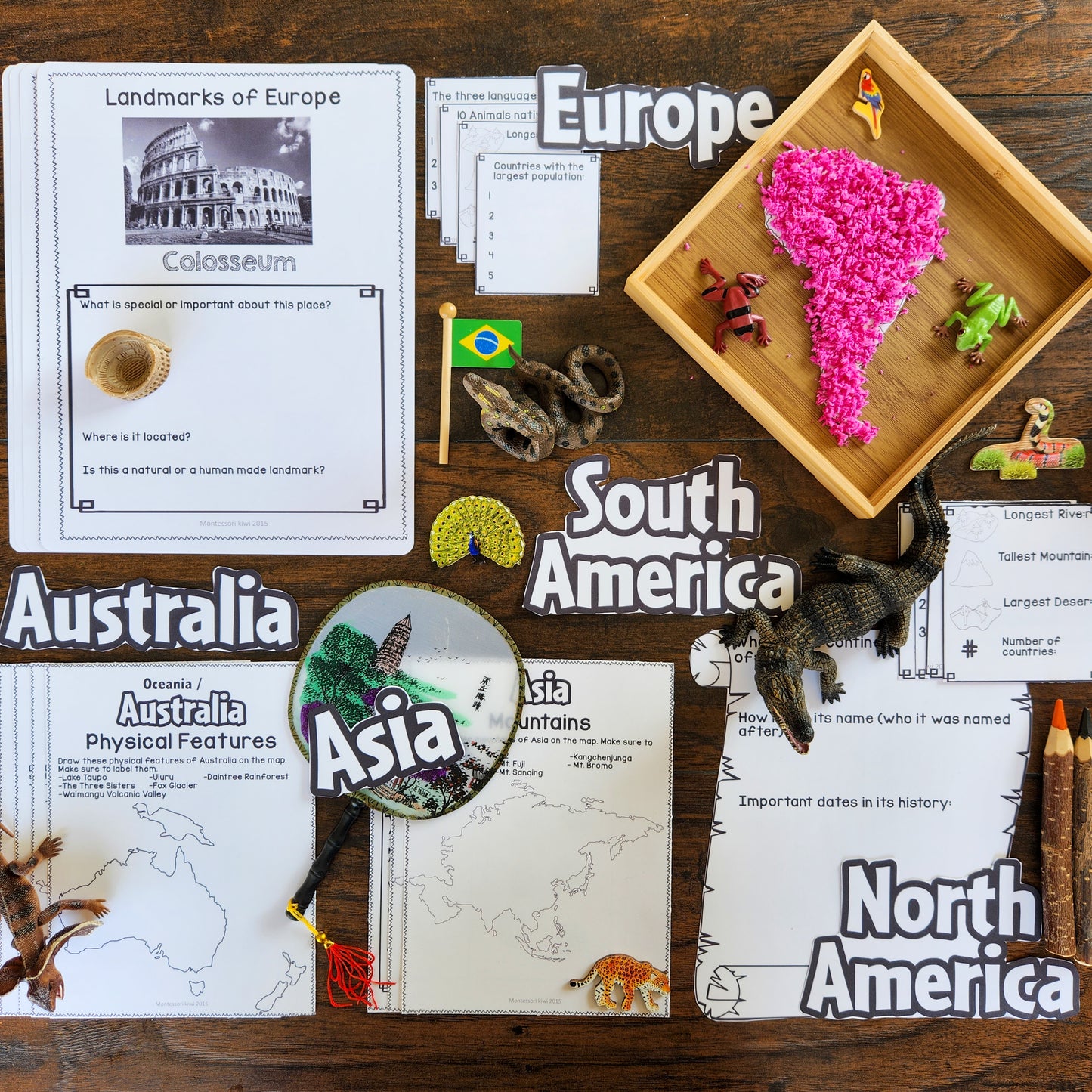
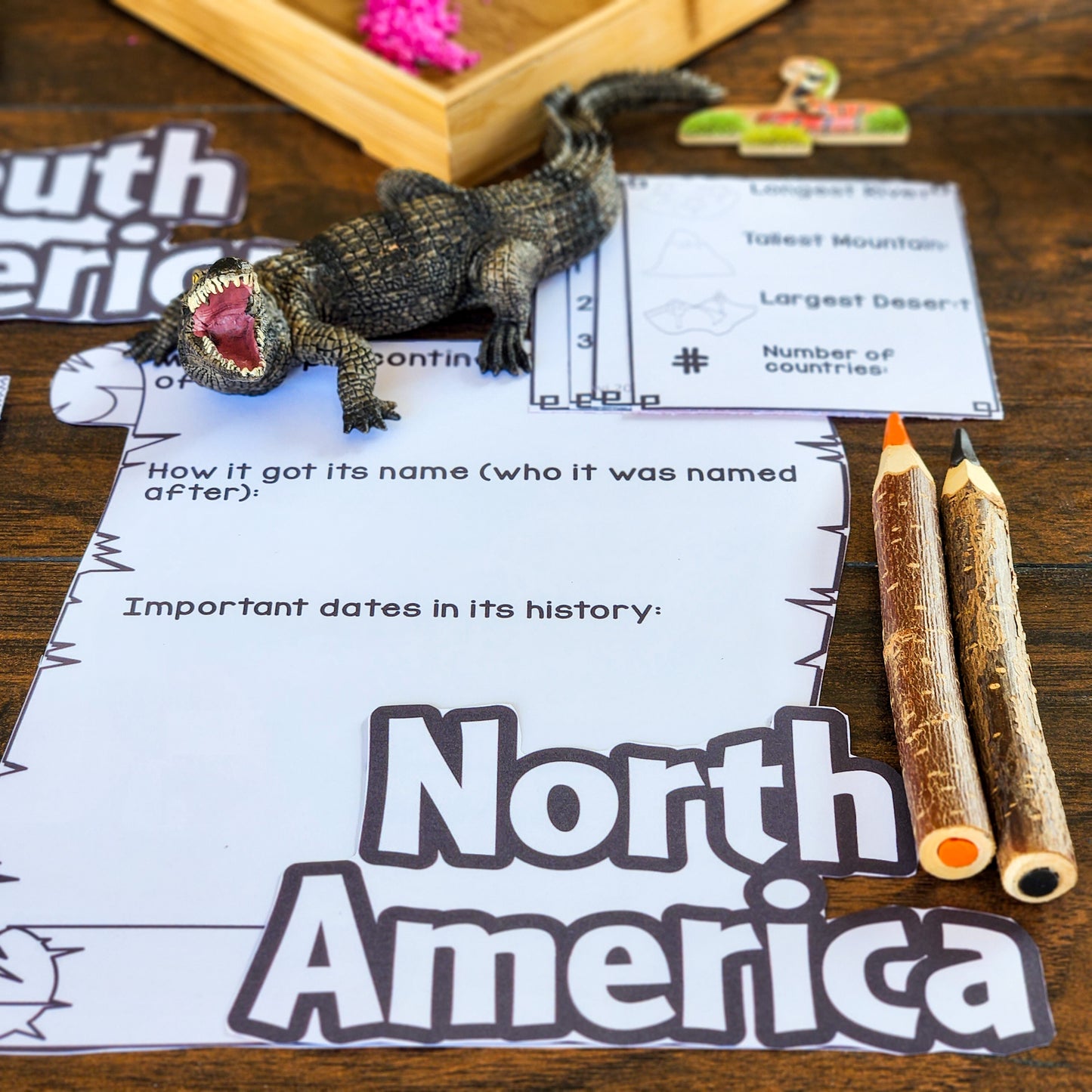
Rather than completing the same simple worksheet for each continent, children examine both physical geography and cultural geography. They map natural features, research living things and landmarks, investigate climate and history, and even plan an imaginary journey through each continent.
At a Glance
Best for: Montessori elementary classrooms, homeschool geography, cultural studies and independent project work
Age range: Approximately 8–12 years, depending on reading and research experience
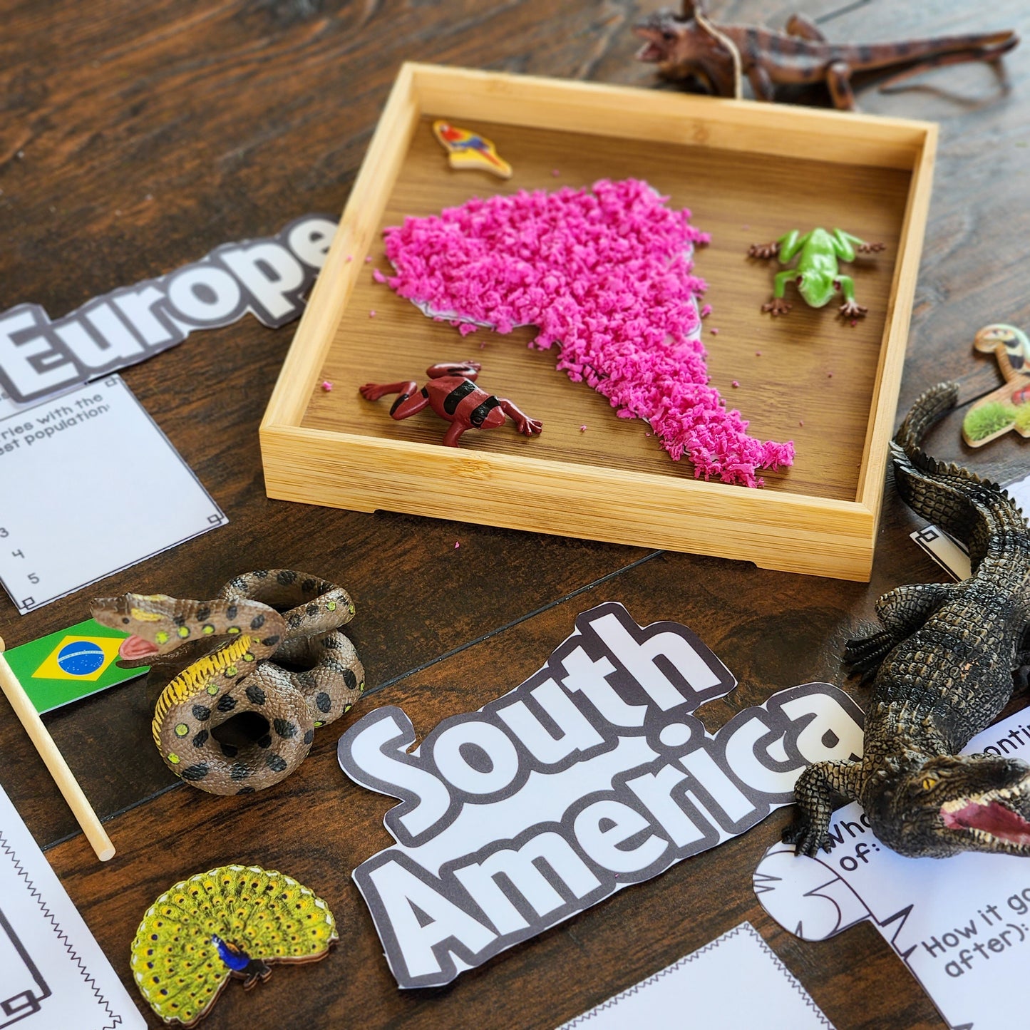
Coverage: Africa, Antarctica, Asia, Europe, North America, South America and Oceania/Australia
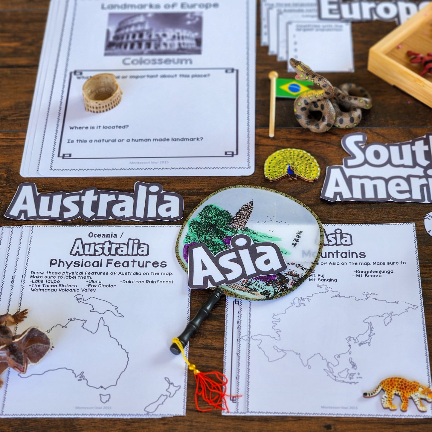
Includes: Mapping, research, writing and project pages for all seven continents
Skills developed: Atlas use, research, map interpretation, writing, organisation and geographical thinking
Format: 71-page black-and-white printable PDF
Use for: Geography folders, continent studies, Cosmic Education, project-based learning and long-term independent work
A Flexible Framework for Deep Continent Study
These activities are not intended to be completed as one large workbook from beginning to end.
Instead, you can select the projects that match each child’s interests, ability and current area of study.
One child might map the major rivers of Africa. Another may research the climate and biomes of South America. A small group could compare landmarks across Asia, while an older learner plans a detailed European travel itinerary.
This flexibility makes the resource particularly useful in mixed-age Montessori environments where children need meaningful choices but still benefit from clear structure.
What Is Included for Each Continent?
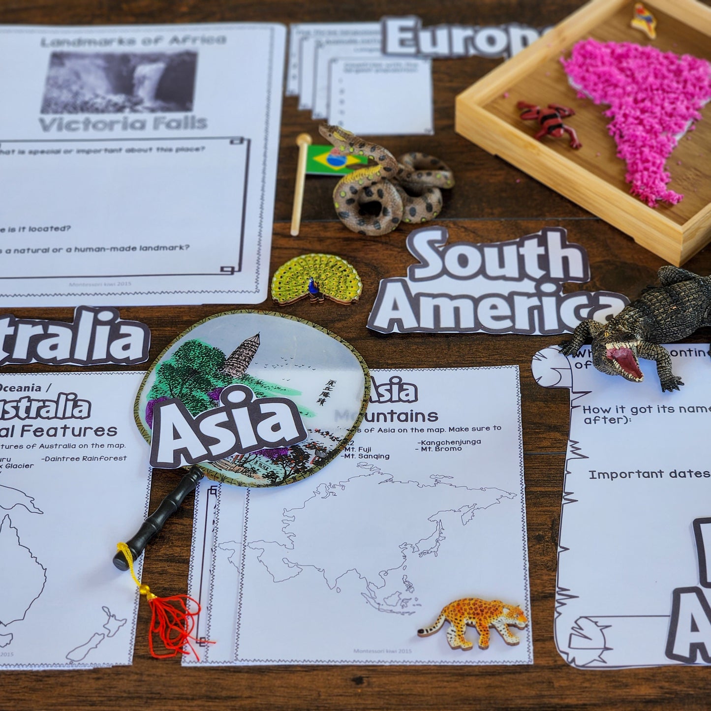
Each continent section includes a combination of map work, research and writing activities.
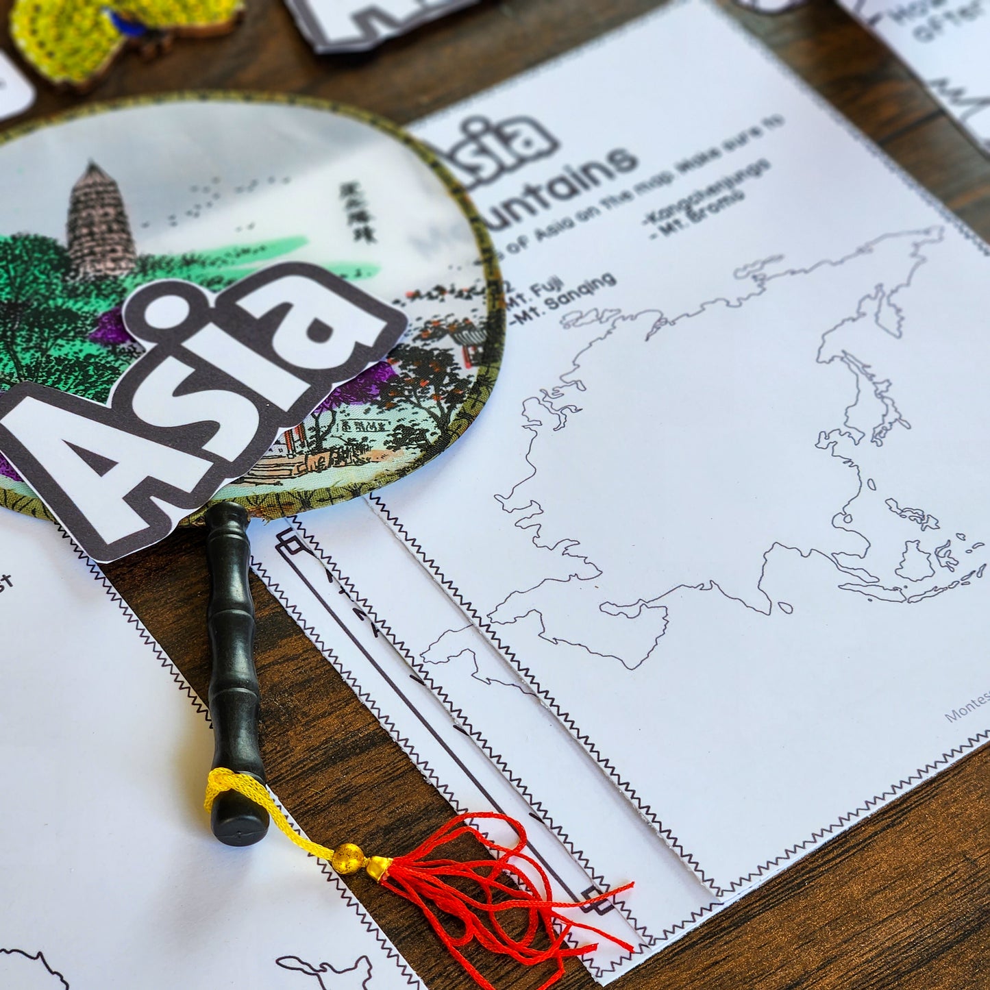
Physical Geography Mapping
- Rivers map: Locate and label important rivers
- Mountain map: Identify major mountains and mountain ranges
- Physical-features map: Explore deserts, lakes, plains, peninsulas and other significant landforms
Continent Quick Facts
Children research and record important information such as:
- the largest countries
- population information
- the highest mountain
- major rivers
- important geographical features
- other notable facts about the continent
Climate and Biome Research
Children investigate the climates and biomes found across the continent and consider how features such as latitude, elevation, rainfall and geography affect living conditions.
History of the Continent
This open-ended project invites children to select and research important historical events, peoples or developments rather than reducing an entire continent to one simplified narrative.
Animal Research
Two animal-research activities are included for each continent, allowing children to explore native species, habitats, adaptations, diet, conservation and geographical distribution.
Landmark Research
Two landmark projects invite children to investigate important natural or human-made places, including their location, purpose, history and significance.
My Itinerary
Children plan an imaginary visit to the continent, choosing destinations and considering:
- countries and cities they would visit
- transport between locations
- landmarks and natural features
- climate and suitable clothing
- activities and experiences
- the order and length of their journey
This project integrates geography with research, practical writing, time, distance, budgeting and decision-making.
Please note: Antarctica contains slightly fewer projects because of its geography, population and settlement patterns.
Designed for Children Ready for Independent Research
This resource is most suitable for children who:
- are fluent enough to read information independently
- have already completed introductory continent and atlas work
- can locate information in books or reliable digital sources
- understand how to record information in their own words
- can manage a short project with some independence
- are ready to move beyond naming continents and countries
Younger children can still complete selected mapping or research pages with adult support, while older elementary learners can extend each project substantially.
Geography That Connects Across the Curriculum
Geography is more than memorising place names.
As children study a continent, they encounter connections with:
- Science: Climate, biomes, animals, adaptation and ecosystems
- History: Migration, settlement, exploration, conflict and social change
- Literacy: Research, note-taking, report writing and presentation
- Mathematics: Distance, scale, population, time and travel planning
- Fundamental Needs: How geography influences food, clothing, shelter, transport and community life
- Cosmic Education: The relationship between the Earth, living things and human societies
The open-ended structure allows children to follow areas of genuine interest while still building a coherent understanding of each continent.
Suggested Ways to Organise the Resource
Create a Continent Project Folder
Place the pages in a ring binder divided by continent. Children can select a project when they are ready for geography follow-up work.
You may wish to use Montessori continent colours for the dividers:
- Africa – green
- Antarctica – white
- Asia – yellow
- Europe – red
- North America – orange
- South America – pink
- Oceania/Australia – brown
Create Geography Shelf Trays
Offer one continent or one type of project at a time. For example, create a tray containing:
- a continent map
- an atlas
- the river-mapping page
- coloured pencils
- relevant books or reference cards
Use a Continent Study Cycle
Focus on one continent for several weeks and allow children to choose from the available map, research and writing projects.
Offer Projects Across the Year
The resource can remain available throughout the year, allowing children to return to different continents as their interests connect with history, science, literature or current studies.
Adaptable for Mixed Ages and Abilities
Not every child needs to complete each project in the same way.
You can differentiate by changing the amount of research, writing or adult support required.
- Children needing more support can work with a partner, use selected reference books or label a reduced number of features.
- Independent learners can complete the page using an atlas and research materials.
- Older learners can add sources, data, timelines, graphs, comparisons or a bibliography.
- Reluctant writers can present some findings orally, through diagrams or in bullet points.
- Highly interested learners can turn one prompt into a substantial report, model or presentation.
This makes the pack valuable for mixed-age classrooms and neurodivergent learners with varied strengths in reading, writing, organisation and independent work.
Possible Teaching Sequence
- Review the continent. Use a globe, puzzle map, control map or atlas to locate it.
- Establish key geographical vocabulary. Discuss terms such as river, mountain range, biome, climate and landmark.
- Model one mapping activity. Demonstrate how to use the atlas key, index and physical map.
- Offer a limited choice of projects. Select activities appropriate to the child’s research experience.
- Conference during the work. Help the child refine questions, select useful information and organise findings.
- Invite children to share. Finished work can be presented to a partner, small group or class.
- Return to the continent over time. Add further physical, cultural, scientific and historical layers.
Why Teachers Value Open-Ended Geography Work
Highly prescribed worksheets can limit both the depth of learning and the child’s opportunity to make choices.
Completely unstructured research, however, can leave children unsure where to begin.
These projects provide a middle ground: each page offers a clear direction while leaving room for children to make decisions, select examples and determine the depth of their work.
This helps develop:
- independent work habits
- research confidence
- questioning and inquiry
- information organisation
- map-reading skills
- global awareness
- connections between physical and human geography
Ideas for Your Montessori Geography Area
Read Geography Extensions for Your Montessori Elementary Classroom for practical ideas about setting up continent folders, organising maps and offering open-ended follow-up work.
Choose the Geography Resource That Fits Your Learners
- Montessori Geography Projects Bundle – get these continent activities together with additional cultural and physical geography projects for lower and upper elementary learners ```
- Montessori Cultural Geography Research Projects – shorter research prompts and printable extensions designed especially for lower elementary learners
- Free Continents of the World Interactive Notebook – review introductory continent knowledge before beginning the larger research projects
- Free Montessori Continent Wheel – a hands-on activity for children still developing confidence with continent recognition
- Browse All Montessori Geography Resources – explore map work, cultural studies, landforms, country projects and Cosmic Education extensions ```
Created for Real Montessori Classrooms
I am a Montessori-trained teacher, New Zealand registered teacher, school principal and former homeschooler.
I originally developed this type of geography work to help elementary children move beyond repeatedly using continent puzzle maps as simple puzzles. Children need opportunities to discover the rivers, mountains, climates, living things, peoples and histories that make every continent complex and fascinating.
My resources are designed from real experience teaching mixed-age learners, including neurodivergent children and children with varied levels of reading, writing and independence.
Important Information
- This is a 71-page digital PDF resource.
- No physical product will be mailed.
- All student activity pages are black and white.
- Children will need access to atlases, books or suitable research sources.
- This resource is most appropriate after introductory continent and atlas work.
- Antarctica contains slightly fewer activities than the other continents.
- Purchase permits use by one classroom or one homeschool family.