


New Zealand Mapping Activities | NZ Regions, Cities, Landmarks & Road Trip Geography
New Zealand Mapping Activities | NZ Regions, Cities, Landmarks & Road Trip Geography
This is a digital item and will be sent instantly. No physical item will be shipped.

Help children build real knowledge of Aotearoa New Zealand through maps, landmarks, regions, cities, and hands-on geography tasks.
Perfect for Years 3–8, homeschool social studies, Montessori cultural geography, and Aotearoa New Zealand histories.
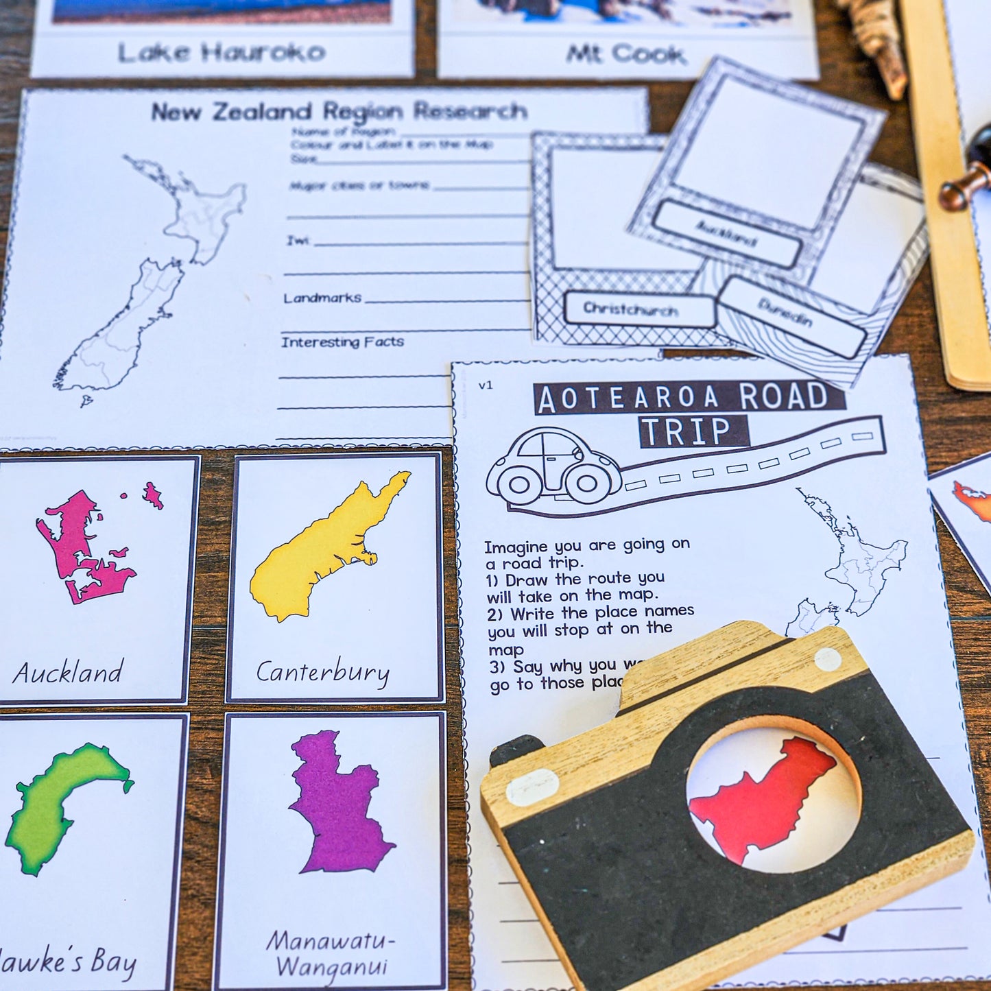
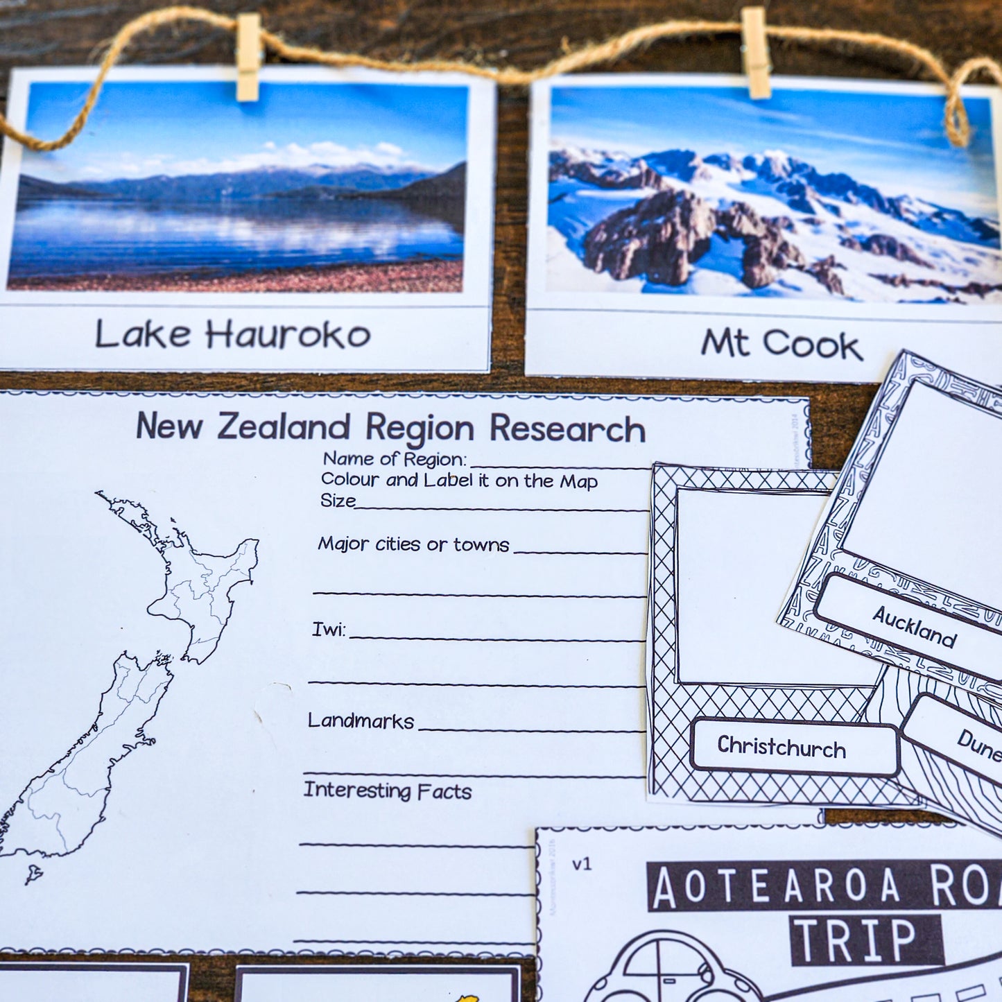
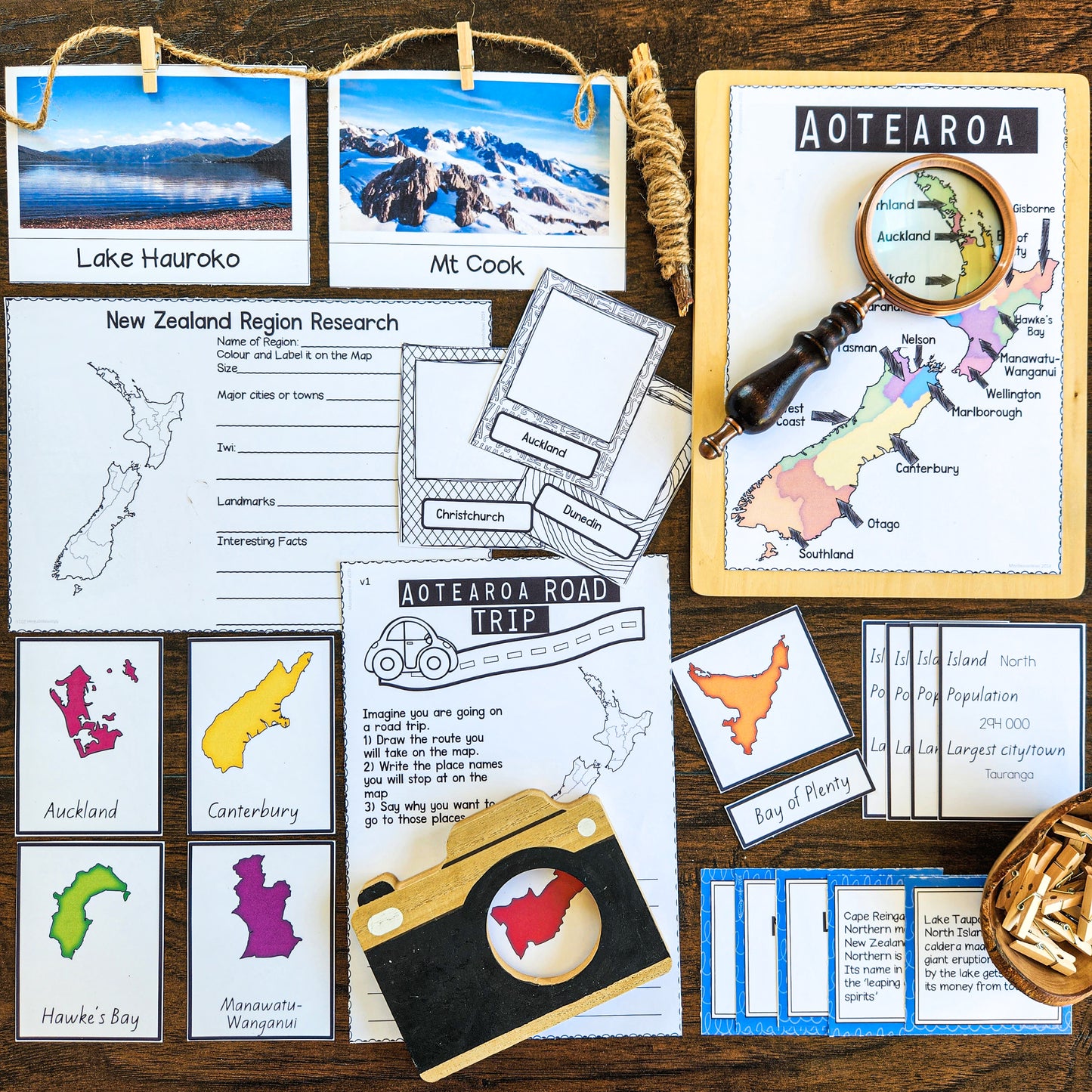
Includes colour and black-and-white maps, English and Māori versions, regional research, landmark photos, matching activities, and a plan-a-road-trip task.
Make New Zealand geography more hands-on, visual, and meaningful with these New Zealand Mapping Activities for social studies, geography, and Montessori cultural work.
Children often know the name “New Zealand” but may not confidently understand the shape of the country, the difference between the North and South Islands, where regions are located, which cities are important, or how landmarks connect to place.
This printable 68-page PDF gives students a practical way to explore Aotearoa New Zealand through maps, photographs, research, drawing, matching, and travel planning.
It is ideal for teachers and homeschoolers who want New Zealand geography work that goes beyond colouring a blank map.
What’s Included
This printable resource includes:
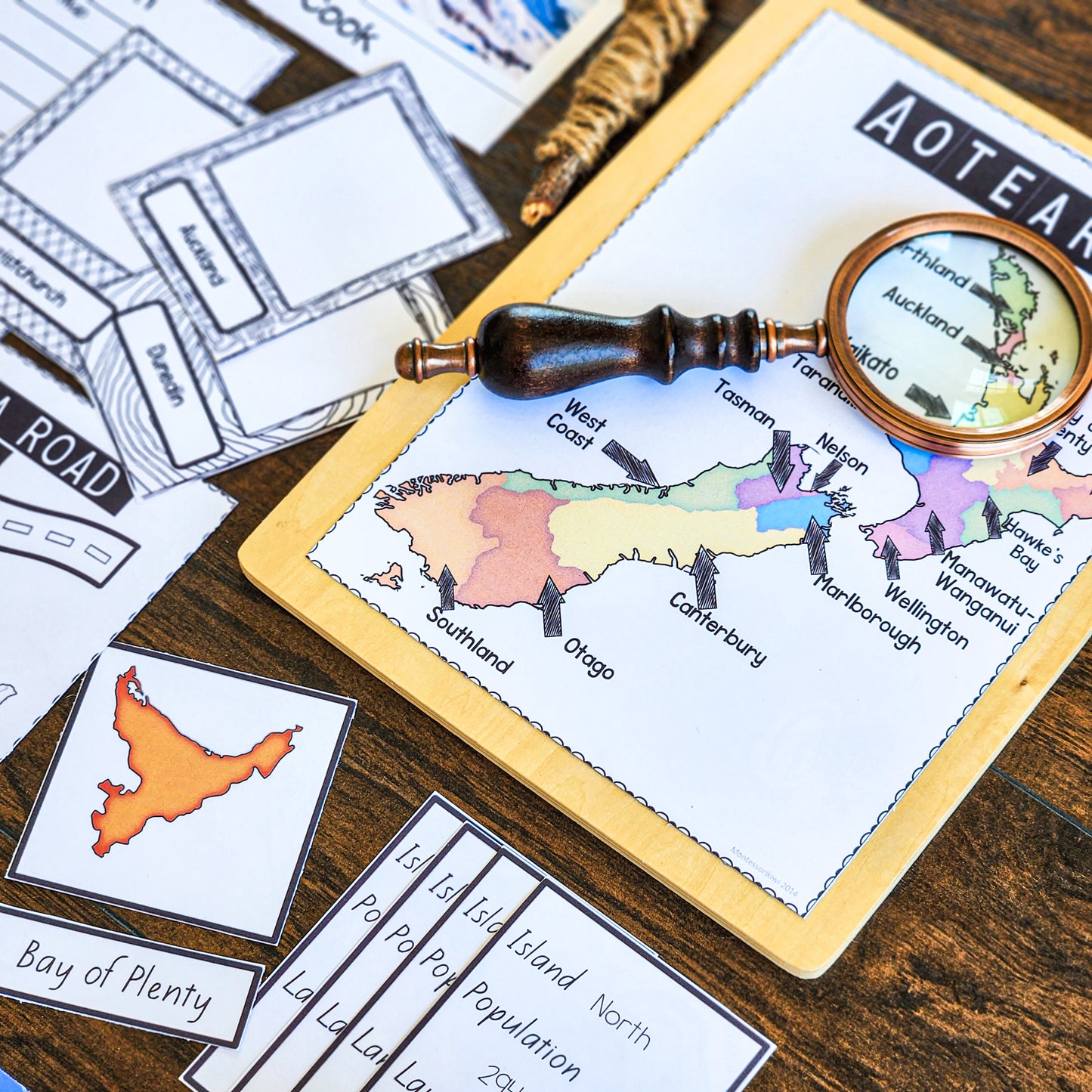
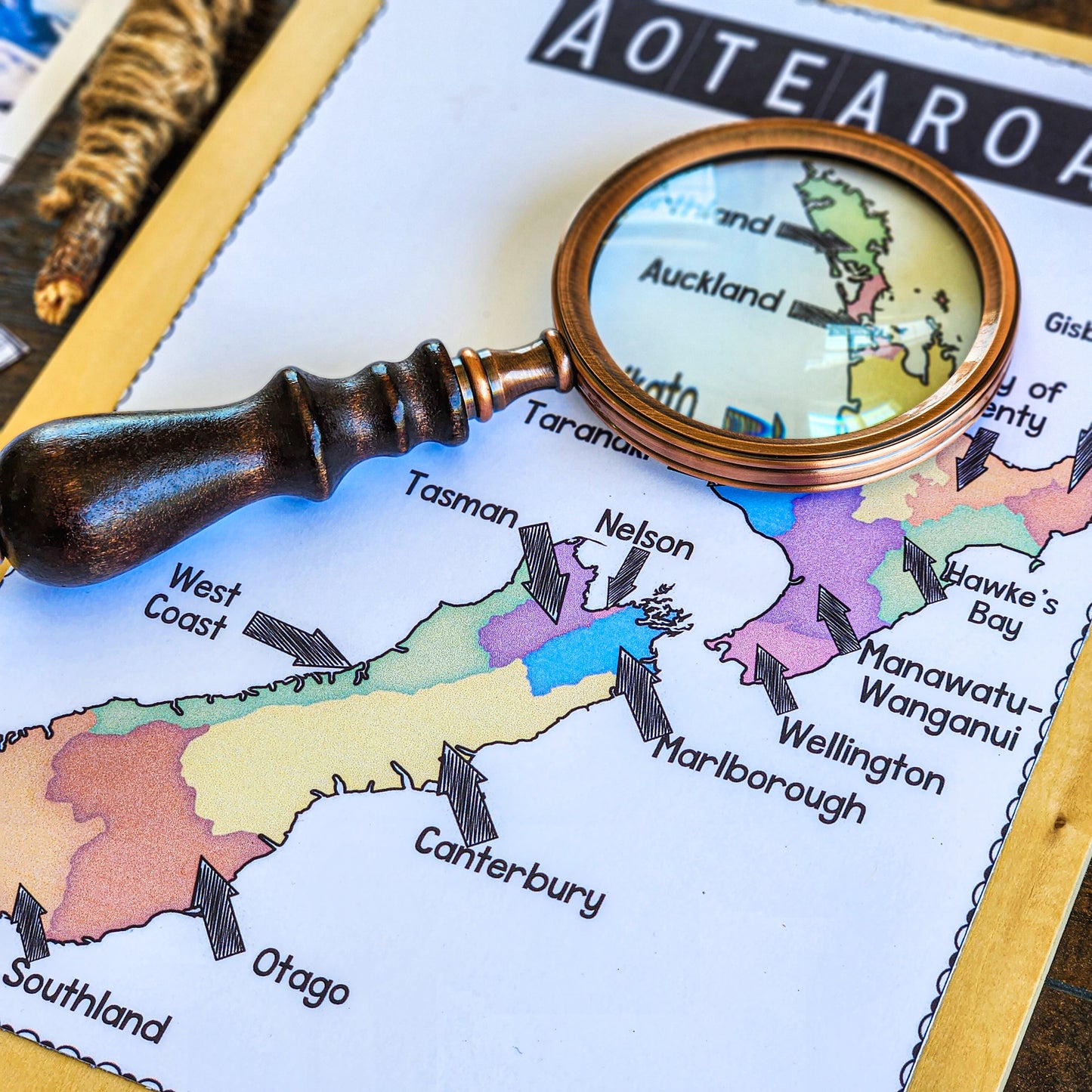
- Colour and black-and-white maps of New Zealand
- Regional map in English and Māori versions
- Major cities map in English and Māori versions
- Island maps in English and Māori versions
- Regional research activity
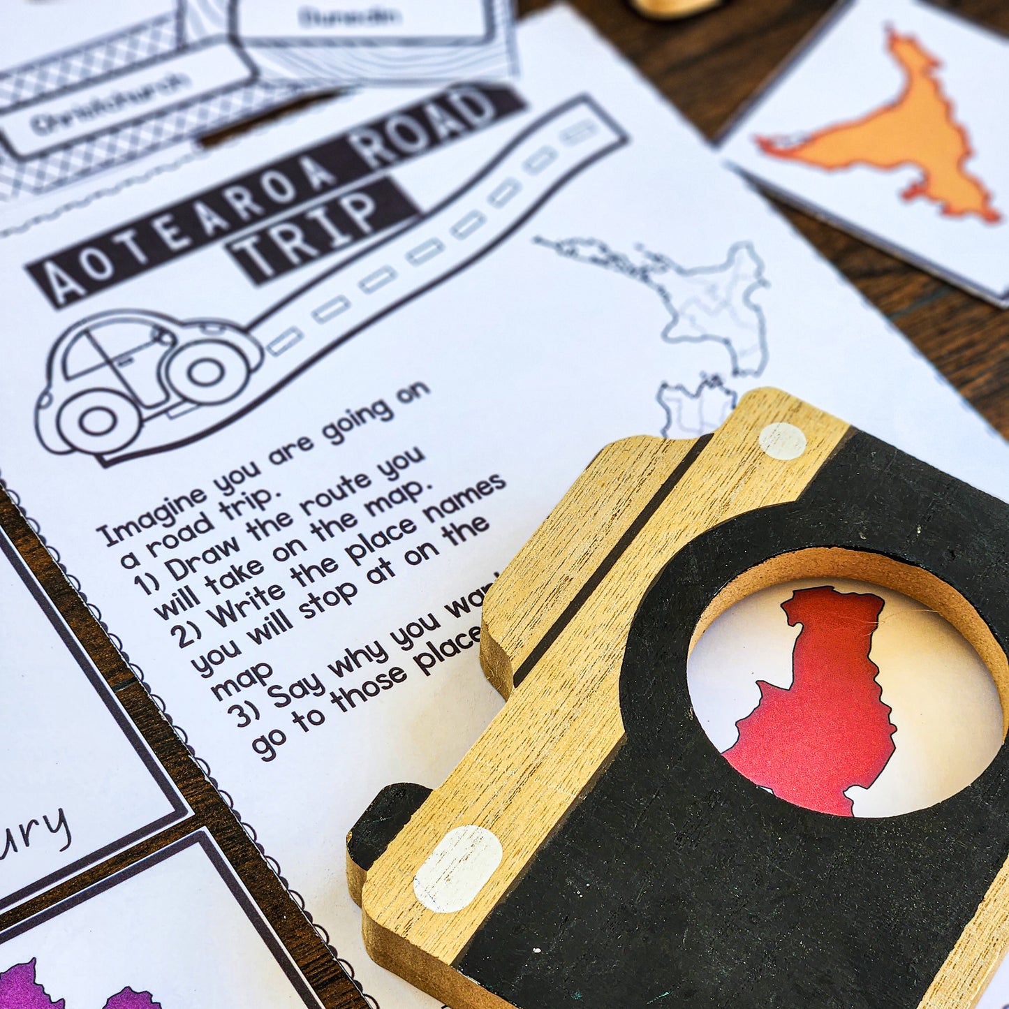
- Plan a road trip around New Zealand activity
- Draw some places around New Zealand activity
- Match-up activity game
- Pictures of important landmarks in New Zealand
- Montessori-inspired geography and social studies activities
The activities support students to identify New Zealand regions, locate each region, and explore the population and key city or town in each region. The original resource is designed for Years 3–8 and includes strong bicultural content.
Why This Resource Works
New Zealand mapping can quickly become passive if children only label places once and move on. This resource gives students repeated ways to return to the map, compare places, notice patterns, and connect geography with real locations.
It supports:
- Aotearoa New Zealand geography
- NZ regions and cities
- North Island and South Island map work
- Māori and English place-name awareness
- Landmark recognition
- Regional research
- Map reading
- Social studies
- Cultural geography
- Independent or partner work
- Homeschool geography lessons
The combination of maps, photographs, matching, drawing, and road-trip planning helps children see geography as connected to real places, travel, people, and communities.
Best For
This resource is ideal for:
- Years 3–8
- New Zealand classrooms
- Homeschool social studies
- Montessori cultural geography
- Aotearoa New Zealand histories
- NZ map skills
- Regional research projects
- Inquiry learning
- Small group work
- Teachers wanting low-prep printable geography resources
Suggested Use
Use this resource during a New Zealand geography unit, Aotearoa New Zealand histories learning, social studies, or cultural geography work.
Students can begin by identifying the islands, regions, and major cities, then move into regional research, landmark matching, drawing activities, or planning a road trip around New Zealand.
This also works well as a rotating geography shelf activity, a partner project, a homeschool unit, or a class inquiry into local places, regions, and landmarks.
Created by Montessori Kiwi
Created by a New Zealand registered teacher and Montessori-trained educator, this resource is designed to help children build a stronger sense of place.
It saves preparation time while giving students purposeful, hands-on ways to explore the geography of Aotearoa New Zealand.
68 PAGES - PDF
This is a Downloadable resource.
See more NZ Resources here


One-time purchase • Lifetime access